Today it was sunny and almost free of any wind. My plan was to fly at the supermarket that has some restoration work going on. I was curious to know if the crane is more than 30m tall. After start and reaching the 30m height limit it was obvious that the crane’s height is around 10 meters over my altitude limit. While getting closer to the crane some features on the ground seam to trick the VPS so I got about 5m higher than I was able to get to at my start position. Later in the flight the crane or the buildings around it tricked the VPS more and more till Tello rose to about 40m altitude! Also the drone dropped many meters while I pushed my stick downwards (I was thankful that it did not fly away) but the altitude measured by the VPS only dropped a fraction of the actual height I lost at this time. I decided to land the drone to re-calibrate the VPS. At the moment of touchdown the indicated altitude was 16.5 meters!
Lesson learned:
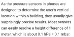
Large structures in the flight area that are visible for the VPS (I expect the bottom facing camera has at least a 60° FOV) indicate false ground levels to the VPS and so the height measurement get messed up. A barometric sensor would help. I once read that there is on in Tello, but this flight let me believe that there is no such device in Tello or the software does not take this data and uses it to “calibrate” the VPS.
I also experienced that moving things like the river let’s Tello think it’s drifting and compensates this. The strange thing was, that it was compensating in the opposite direction. I have a short recording of the incident since I very quickly get back over land to not lose the drone.
Lesson learned:
Large structures in the flight area that are visible for the VPS (I expect the bottom facing camera has at least a 60° FOV) indicate false ground levels to the VPS and so the height measurement get messed up. A barometric sensor would help. I once read that there is on in Tello, but this flight let me believe that there is no such device in Tello or the software does not take this data and uses it to “calibrate” the VPS.
I also experienced that moving things like the river let’s Tello think it’s drifting and compensates this. The strange thing was, that it was compensating in the opposite direction. I have a short recording of the incident since I very quickly get back over land to not lose the drone.